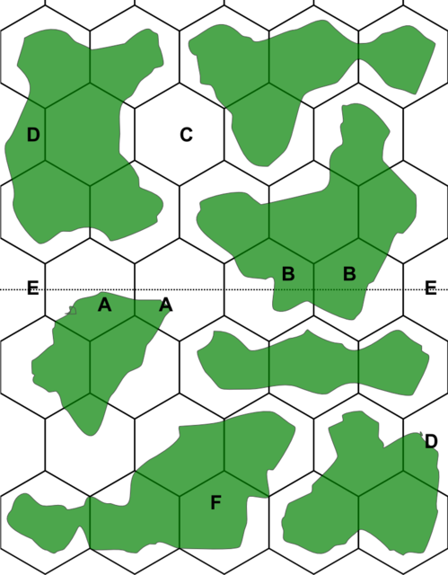
This is an example of how I intend to use the map. There are various details to explain.
To make sure the top and bottom part are tillable with other parts, the continents can be designed to stay on their side of the line like shown in "A" or there could be a universal way to connect over the dotted line like shown in "B". This would allow continents to connect to the other side of the tile and allow various configurations.
Each tile will have a couple of water only hex like "C". This would require better ships to be able to cross it.
For the half hexes, one side of the map will use the half hex while the other side do not use it to make sure there is no conflict. That is the case with Hex "D". This way, these hexes are not lost.
As for hex "E", These hexes are currently water hex and I think it should be a good idea, it would add some spacing between continents
Finally, continent "F" has been drawn in a different way than other continents. Each side of the hex on that continent either has full land or full water. So an hex side never get cuts in half. There are various pro and cons to use this technique, I was just wondering if it was a good idea to use it.
BY thinking about it, the continents I have drawn above are pretty small. It might be a better idea to create much larger continents. I'll have to make layout test and determine some map creation rules.


